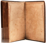
Voyages from Montreal on the river St Laurence, through the continent of North America, to the Frozen and Pacific Oceans; in the years 1789 and 1793. With a preliminary account of the rise, progress, and present state of the fur trade of that country
Author: Alexander Mackenzie (c1764-1820)
Year: 1801
Publisher: Printed for T. Cadell, et al. by R. Noble
Place: New York
Description:
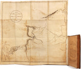
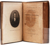
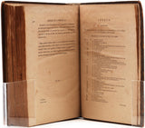
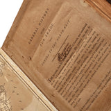
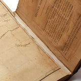
[4]+viii+cxxxii+412+[2] pages with half-title, engraved portrait frontispiece, title page, (3) large folding maps, and final errata pages. Quarto (10 7/8" x 8 7/8") bound in tree calf with gilt-titled red morocco label to the spine. (Sabin 43414; Howes M133) First Edition.
Sir Alexander Mackenzie was a Scottish explorer and fur trader known for accomplishing the first crossing of North America by a European in 1793.
On behalf of the North West Company, Mackenzie journeyed to Lake Athabasca where, in 1788, he was one of the founders of Fort Chipewyan. He had been sent to replace Peter Pond, a partner in the North West Company. From Pond, he learned that the First Nations people understood that the local rivers flowed to the north-west. Thinking that it would lead to Cook Inlet in Alaska, he set out by canoe on the river known to the local Dene First Nations people as the Dehcho (Mackenzie River), on 3 July 1789.
In 1791, Mackenzie returned to Great Britain to study the new advance in the measurement of longitude. In the aftermath of the Nootka Crisis with Spain, he returned to Canada in 1792, and set out to find a route to the Pacific. Accompanied by two native guides (one named Cancre), his cousin, Alexander MacKay, six Canadian voyageurs (Joseph Landry, Charles Ducette, François Beaulieu, Baptiste Bisson, Francois Courtois, Jacques Beauchamp), and a dog simply referred to as "our dog", Mackenzie left Fort Chipewyan on 10 October 1792, and travelled via the Pine River to the Peace River. From there he travelled to a fork on the Peace River arriving 1 November where he and his cohorts built a fortification that they resided in over the winter. Mackenzie left Fort Fork on 9 May 1793, following the route of the Peace River. He crossed the Great Divide and found the upper reaches of the Fraser River, but was warned by the local natives that the Fraser Canyon to the south was unnavigable and populated by belligerent tribes. He was instead directed to follow a grease trail by ascending the West Road River, crossing over the Coast Mountains and descending the Bella Coola River to the sea. He followed this advice and reached the Pacific coast on 20 July 1793, at Bella Coola, British Columbia, on North Bentinck Arm, an inlet of the Pacific Ocean. Having done this, he had completed the first recorded transcontinental crossing of North America north of Mexico, 12 years before Lewis and Clark.
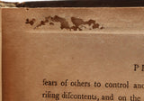
Condition: Light age wear to boards with repairs to lower board, light edgewear, and corners bumped and rubbed; spine with small chips and age cracking to leather, ends lightly rubbed, label with chip and pealing at center, joints lightly rubbed; lacking front free endpapers otherwise complete; pages toned with offsetting, patches of insect damage (sometimes substantial) on several leaves, occasional small edge chip/tear/fraying, and foxing and spotting; area of damp staining on frontispiece and title with frequent additional small or faint areas of damp staining at margins; one page with old writing otherwise pages unmarked; maps complete but with typical toning and offsetting, light scattered foxing (heavier on third), and repairs, the first with faint area of damp staining and edge chip, the second with small loss at vertical fold, the third with (2) small tears at folds. A good or better copy.


