


A Voyage to the South-Sea And along the Coasts of Chili and Peru, in the Years 1712, 1713, and 1714 Particularly Describing the Genius and Constitution of the Inhabitants, as well Indians as Spaniards: Their Customs and Manners, Their Natural History,
Author: Frezier, Amedee Francois (1682-1773)
Year: 1717
Publisher: Jonah Bowyer
Place: London
Description:
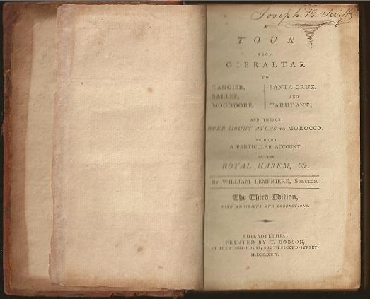
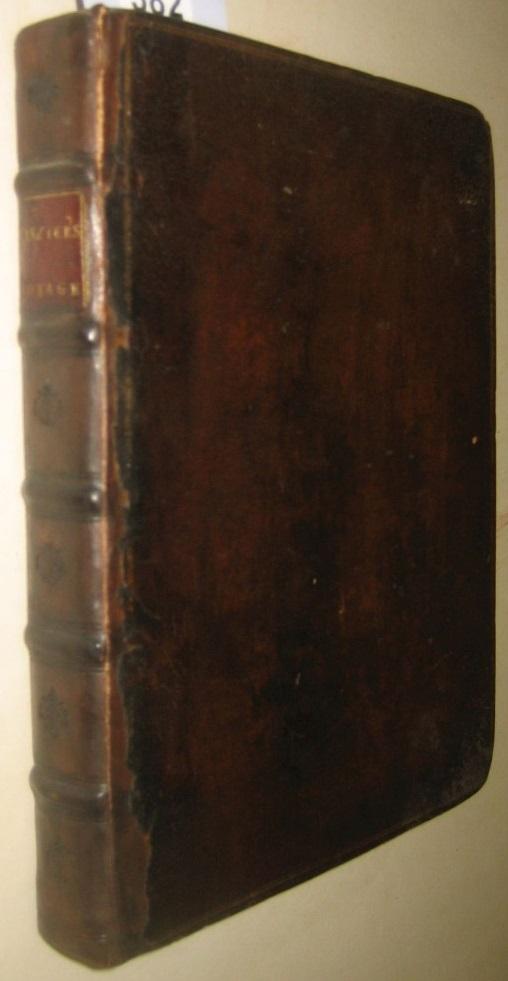
355+[9]+index pages 36 of 37 maps and copper cuts of the coasts, harbor, cities, plants and other curiosities (comprising: 14 plates [3 folding], 22 maps, charts or plans [14 folding]). Title page printed in red and black. Printed from the author's original plates inserted in the Paris edition. Lacks the frontispiece map. Royal octavo (9 3/4" x 7 3/4") bound in leather with raised spine bands and red label with gilt lettering. Postscript by Dr Edmund Halley and an account of the settlement, commerce and riches of the Jesuits in Paraguay. (Palau 94965, Sabin 25926, Nissen ZBI 1433, Hill p117) First English edition.
Frézier was educated in Paris and served as lieutenant of infantry from 1702 til 1707, when he entered the engineer corps. Frézier's superior officers, impressed by his competence, recommended that Frézier be the one to receive the assignment of studying the defense fortifications of Chile and Peru. Frézier was a lieutenant-colonel of the French Army Intelligence Corps when on January 7, 1712 he was dispatched to South America, four months after the return from the same continent of Louis Feuillée. The goal of Frezier's reconnaissance mission seems to have included making hydrographical observations, correcting existing charts, and taking exact plans of the most important ports and fortresses along the coasts. Frézier ended up disagreeing with Feuillée in regards to the latter's measurement of the latitudes and longitudes of the South American coast and of the principal ports of Chile and Peru. Frézier actually pointed out several mistakes in Feuillée's Relation, which led to a bitter feud between the two travelers. Sailing aboard the St. Joseph, an armed merchant ship, for about five months, he arrived in Concepción, Chile, on June 16, 1712 after rounding Cape Horn. Passing himself off as a trader or merchant captain so that he could visit the fortifications as a tourist. Frézier ingratiated himself with the Spanish Governors, and based in Concepción, sketched maps of the ports that showed the best approaches for attack, where ammunition was stored and the routes of escape, estimated the strength of the Spanish colonial governments, the state of these colonies' natives, and examined the Spanish gold and silver mines. He also reported on the operations of the Church, the physical geography and flora and fauna of the area, as well as its agricultural products – such as the species of strawberry that he would subsequently introduce to Europe. About the beach strawberry, Frézier wrote: "They there cultivate entire fields of a type of strawberry differing from ours by their rounder leaves, being fleshier and having strong runners. Its fruit are usually as large as a whole walnut, and sometimes as a small egg. They are of a whitish-red colour and a little less delicate to the taste than our woodland strawberries." This was first published in France in 1714. The first edition into English is preferable to the French original "because it contains Halley's.... postscript, which corrects certain geographical errors made by Frézier" (Hill). "The first part of this book gives an interesting account of the voyage from France around Cape Horn... The second part relates to the voyage along the coasts of Chile and Peru, describing the chief towns and cities. Frézier, a man of observation, brought back information of considerable geographical and scientific value. Much data is included about the native inhabitants.
Condition:
Rebacked with original spine label laid down; lacking frontispiece map and binder's leaf, free endpapers renewed, intermittent foxing else a very nice copy.
Year: 1717
Publisher: Jonah Bowyer
Place: London
Description:
355+[9]+index pages 36 of 37 maps and copper cuts of the coasts, harbor, cities, plants and other curiosities (comprising: 14 plates [3 folding], 22 maps, charts or plans [14 folding]). Title page printed in red and black. Printed from the author's original plates inserted in the Paris edition. Lacks the frontispiece map. Royal octavo (9 3/4" x 7 3/4") bound in leather with raised spine bands and red label with gilt lettering. Postscript by Dr Edmund Halley and an account of the settlement, commerce and riches of the Jesuits in Paraguay. (Palau 94965, Sabin 25926, Nissen ZBI 1433, Hill p117) First English edition.
Frézier was educated in Paris and served as lieutenant of infantry from 1702 til 1707, when he entered the engineer corps. Frézier's superior officers, impressed by his competence, recommended that Frézier be the one to receive the assignment of studying the defense fortifications of Chile and Peru. Frézier was a lieutenant-colonel of the French Army Intelligence Corps when on January 7, 1712 he was dispatched to South America, four months after the return from the same continent of Louis Feuillée. The goal of Frezier's reconnaissance mission seems to have included making hydrographical observations, correcting existing charts, and taking exact plans of the most important ports and fortresses along the coasts. Frézier ended up disagreeing with Feuillée in regards to the latter's measurement of the latitudes and longitudes of the South American coast and of the principal ports of Chile and Peru. Frézier actually pointed out several mistakes in Feuillée's Relation, which led to a bitter feud between the two travelers. Sailing aboard the St. Joseph, an armed merchant ship, for about five months, he arrived in Concepción, Chile, on June 16, 1712 after rounding Cape Horn. Passing himself off as a trader or merchant captain so that he could visit the fortifications as a tourist. Frézier ingratiated himself with the Spanish Governors, and based in Concepción, sketched maps of the ports that showed the best approaches for attack, where ammunition was stored and the routes of escape, estimated the strength of the Spanish colonial governments, the state of these colonies' natives, and examined the Spanish gold and silver mines. He also reported on the operations of the Church, the physical geography and flora and fauna of the area, as well as its agricultural products – such as the species of strawberry that he would subsequently introduce to Europe. About the beach strawberry, Frézier wrote: "They there cultivate entire fields of a type of strawberry differing from ours by their rounder leaves, being fleshier and having strong runners. Its fruit are usually as large as a whole walnut, and sometimes as a small egg. They are of a whitish-red colour and a little less delicate to the taste than our woodland strawberries." This was first published in France in 1714. The first edition into English is preferable to the French original "because it contains Halley's.... postscript, which corrects certain geographical errors made by Frézier" (Hill). "The first part of this book gives an interesting account of the voyage from France around Cape Horn... The second part relates to the voyage along the coasts of Chile and Peru, describing the chief towns and cities. Frézier, a man of observation, brought back information of considerable geographical and scientific value. Much data is included about the native inhabitants.
Condition:
Rebacked with original spine label laid down; lacking frontispiece map and binder's leaf, free endpapers renewed, intermittent foxing else a very nice copy.