


A voyage of discovery to the North Pacific Ocean and round the world; in which the coast of North-west America has been carefully examined
Author: George Vancouver (1757-1798)
Year: 1801
Publisher: John Stockdale
Place: London
Description:
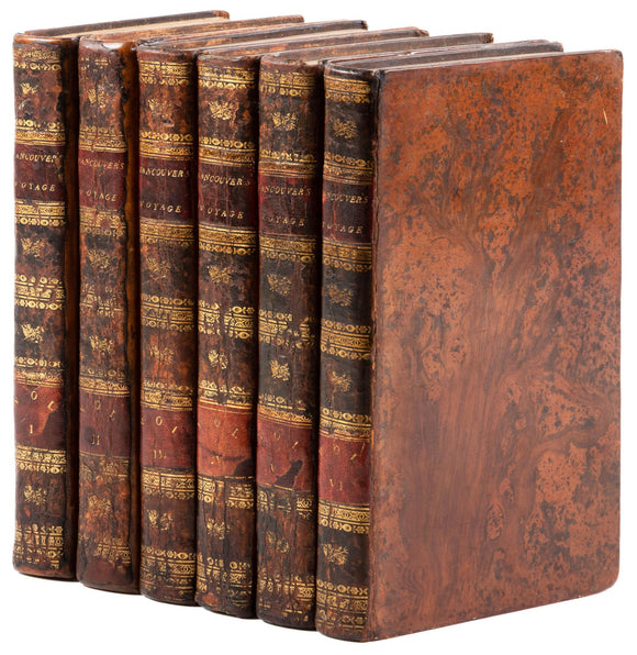
6 Volumes. 28+[33]-410 pages with 2 folding copper-engraved charts and one foldout plate; [2]+418 pages with four folding plates, lacking the plates which should face pages 77 and 134; [2]+435 pages with one folding plate; [2]+417 pages with three folding plates;[2]+454 pages with three folding plates; [2]+412+[2 ad] pages with three folding plates. Folding plates are copper-engraved; engraved by Landseer and others after W. Alexander, most from sketches made "on the spot" by Sykes, Heddington and others. Octavos (8 1/4 x 5") bound period tree calf with spines tooled in gilt, morocco lettering pieces. (Cowan p.654-5; Forbes 335; Hill, Pacific Voyages, pp.304; Howes V23; Sabin 98441; Streeter Sale 3497) First octavo edition.
First published in 1798. George Vancouver entered the Royal Navy in 1771. Some person with influence brought him to the attention of James Cook, then preparing for the second of his three great voyages of discovery. In January 1772 Cook appointed Vancouver to his ship, the Resolution. Though he had the nominal rank of able-bodied seaman, Vancouver was actually a midshipman-in-training. William Wales, a noted astronomer, was a supernumerary on board, and Vancouver was privileged to receive instruction under him. The voyage, in search of the legendary southern continent, lasted three years. In February 1776 Cook appointed Vancouver a midshipman on the Discovery, which was to accompany the Resolution on his third expedition, sent out in search of a Pacific outlet to the fabled northwest passage. The Admiralty was anxious to find out once and for all whether or not a passage existed between the Pacific and the Atlantic. In the autumn of 1789 it was decided to send an expedition to settle the question. A suitable ship of 340 tons burthen was purchased, named Discovery, and commissioned in 1790. The command was given to Captain Henry Roberts, who, like Vancouver, had sailed with Cook on his second and third voyages. Vancouver was appointed second in command. Sailing north, he began the survey that he was to continue through all the complexities of the coastline to a point beyond 60°. Juan de Fuca Strait, to which he had been directed to give particular attention, was reached on 29 April. Vancouver has been much criticized for his failure to enter the Columbia River, the mouth of which he passed as he sailed northward. By August Vancouver had worked his way up the full length of what is now Vancouver Island, establishing its insularity when his ships emerged in Queen Charlotte Sound on 9 August. At the end of the 1793 season Vancouver again visited Alta California enroute to winter quarters in the Sandwich Islands. After calling at Monterey he went on to San Diego and then, fulfilling his instructions, sailed southward along the Mexican coast to extend his survey to the appointed limit of 30°. In two seasons he had thus traced the coast from 30°N to 56°N and had proved that Juan de Fuca Strait was not the entrance to a great inland sea, as Fuca* had alleged, and that the extensive waterways Bartholomew de Fonte* claimed to have entered in latitude 53° did not exist.
Condition:
Spines rebacked with original spines laid down, some light wear to extremities; light foxing; a few plates creased, lacking the plates which should face pp. 77 and 134 in Vol II; short stub tear to one map with tape repair; else very good.